© Valery Dembitsky
\ Highway No 1 Tel Aviv Jerusalem
© Valery Dembitsky
\ Highway No 1 Tel Aviv Jerusalem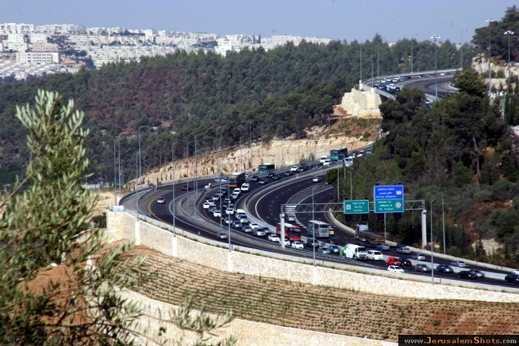
20 July 2009
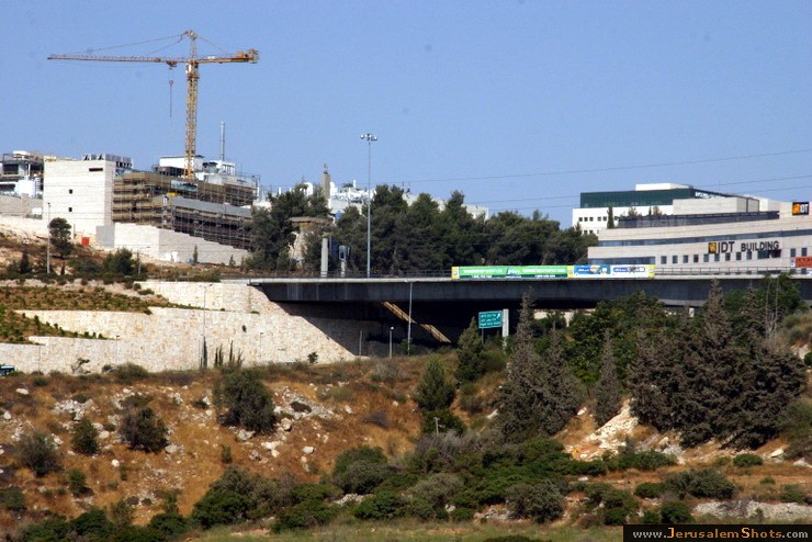
Highway No 1 is the main highway connecting Tel Aviv with Jerusalem. Highway continues into the occupied West Bank past the Israeli settlement of Ma'ale Adummim, and is then downgraded in size until the Beit HaArava Junction with Route 90 south of Jericho near the shores of the Dead Sea.
Highway No 1 is the main highway connecting Tel Aviv with Jerusalem. Highway continues into the occupied West Bank past the Israeli settlement of Ma'ale Adummim, and is then downgraded in size until the Beit HaArava Junction with Route 90 south of Jericho near the shores of the Dead Sea.
© Valery Dembitsky
\ Highway No 1 Tel Aviv Jerusalem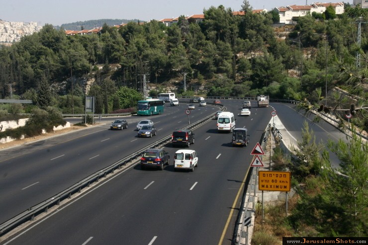
20 July 2009
Highway No 1 is the main highway connecting Tel Aviv with Jerusalem. Highway continues into the occupied West Bank past the Israeli settlement of Ma'ale Adummim, and is then downgraded in size until the Beit HaArava Junction with Route 90 south of Jericho near the shores of the Dead Sea.
Highway No 1 is the main highway connecting Tel Aviv with Jerusalem. Highway continues into the occupied West Bank past the Israeli settlement of Ma'ale Adummim, and is then downgraded in size until the Beit HaArava Junction with Route 90 south of Jericho near the shores of the Dead Sea.
© Valery Dembitsky
\ Synagogue, Mevaseret Zion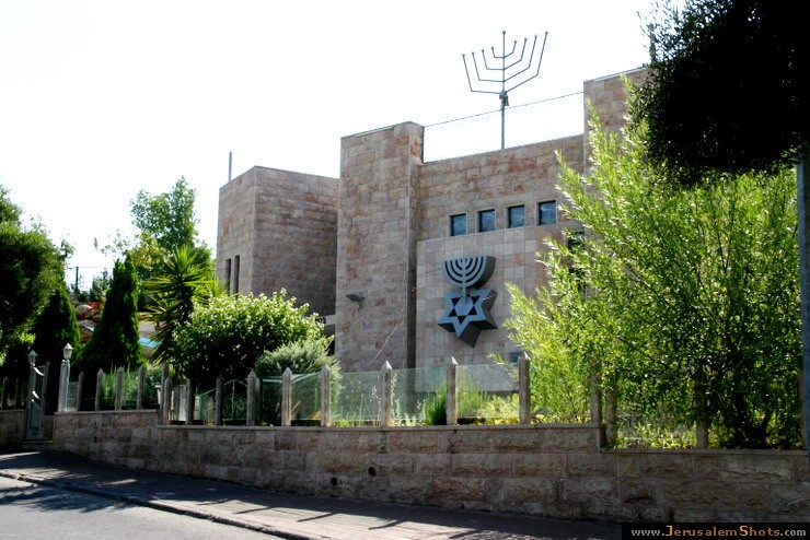
20 July 2009
Mevaseret Zion is a suburb of Jerusalem. Today, Mevaseret Zion is composed of two distinct settlements—Maoz Zion and Mevaseret Yerushalayim—under the jurisdiction of one local council. The newer neighborhoods of Mevaseret Zion were not part of either settlement. Mevaseret Zion is located on a mountain ridge 750 meters above sea level, on the outskirts of Jerusalem.
Mevaseret Zion is a suburb of Jerusalem. Today, Mevaseret Zion is composed of two distinct settlements—Maoz Zion and Mevaseret Yerushalayim—under the jurisdiction of one local council. The newer neighborhoods of Mevaseret Zion were not part of either settlement. Mevaseret Zion is located on a mountain ridge 750 meters above sea level, on the outskirts of Jerusalem.
© Valery Dembitsky
\ Highway No 1 Tel Aviv Jerusalem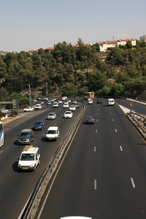
20 July 2009
Highway No 1 is the main highway connecting Tel Aviv with Jerusalem. Highway continues into the occupied West Bank past the Israeli settlement of Ma'ale Adummim, and is then downgraded in size until the Beit HaArava Junction with Route 90 south of Jericho near the shores of the Dead Sea.
Highway No 1 is the main highway connecting Tel Aviv with Jerusalem. Highway continues into the occupied West Bank past the Israeli settlement of Ma'ale Adummim, and is then downgraded in size until the Beit HaArava Junction with Route 90 south of Jericho near the shores of the Dead Sea.
© Valery Dembitsky
\ Highway No 1 Tel Aviv Jerusalem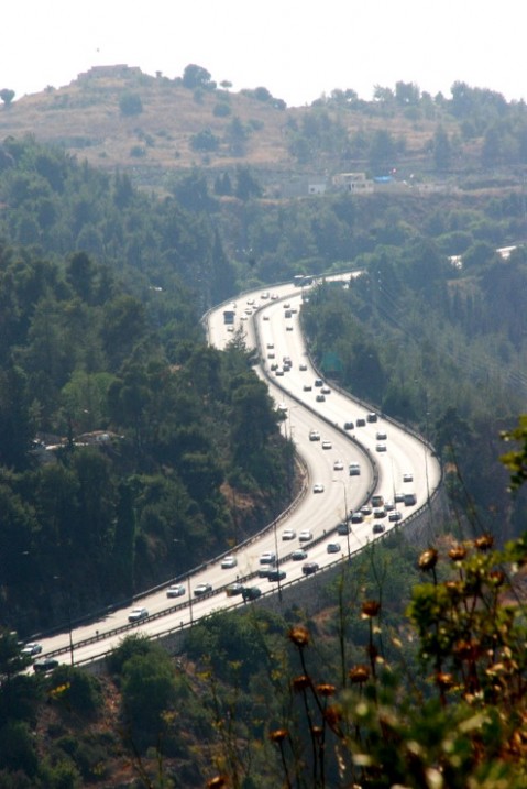
20 July 2009
Highway No 1 is the main highway connecting Tel Aviv with Jerusalem. Highway continues into the occupied West Bank past the Israeli settlement of Ma'ale Adummim, and is then downgraded in size until the Beit HaArava Junction with Route 90 south of Jericho near the shores of the Dead Sea.
Highway No 1 is the main highway connecting Tel Aviv with Jerusalem. Highway continues into the occupied West Bank past the Israeli settlement of Ma'ale Adummim, and is then downgraded in size until the Beit HaArava Junction with Route 90 south of Jericho near the shores of the Dead Sea.
© Valery Dembitsky
\ Highway No 1 Tel Aviv Jerusalem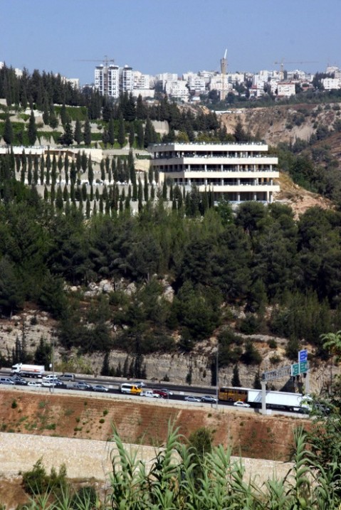
20 July 2009
Highway No 1 is the main highway connecting Tel Aviv with Jerusalem. Highway continues into the occupied West Bank past the Israeli settlement of Ma'ale Adummim, and is then downgraded in size until the Beit HaArava Junction with Route 90 south of Jericho near the shores of the Dead Sea.
Highway No 1 is the main highway connecting Tel Aviv with Jerusalem. Highway continues into the occupied West Bank past the Israeli settlement of Ma'ale Adummim, and is then downgraded in size until the Beit HaArava Junction with Route 90 south of Jericho near the shores of the Dead Sea.
© Valery Dembitsky
\ Castel, Maoz Zion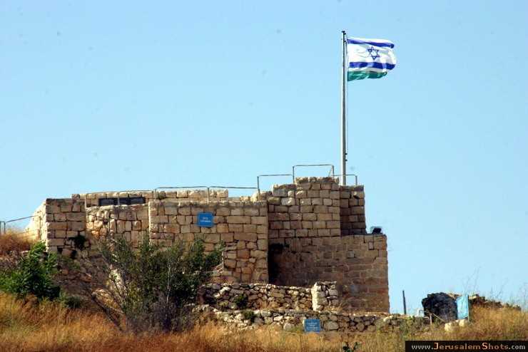
20 July 2009
During the British Mandate of Palestine, the British referred to this district as "The Castle," dropping the "t" as is customary in English. The Arabs called it al-Qastal, pronouncing the "t." The Jews called it "Hacastel" ("the Castel").
During the British Mandate of Palestine, the British referred to this district as "The Castle," dropping the "t" as is customary in English. The Arabs called it al-Qastal, pronouncing the "t." The Jews called it "Hacastel" ("the Castel").
© Valery Dembitsky
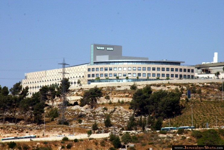
\ Views on Jerusalem from Mevaseret Zion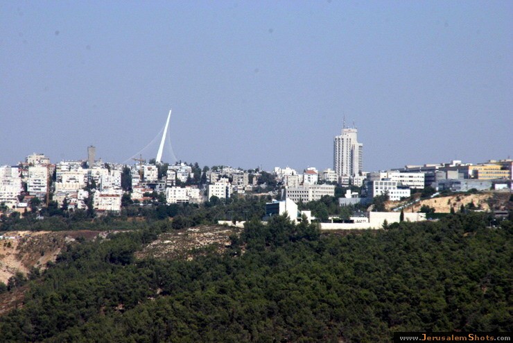
20 July 2009
Mevaseret Yerushalayim (Zion)was established east of Ma'oz Zion in 1956 by Jewish immigrants from North Africa. It was located on a ridge near the armistice line, north of Motza.
Mevaseret Yerushalayim (Zion)was established east of Ma'oz Zion in 1956 by Jewish immigrants from North Africa. It was located on a ridge near the armistice line, north of Motza.
© Valery Dembitsky
\ Views on Jerusalem from Mevaseret Zion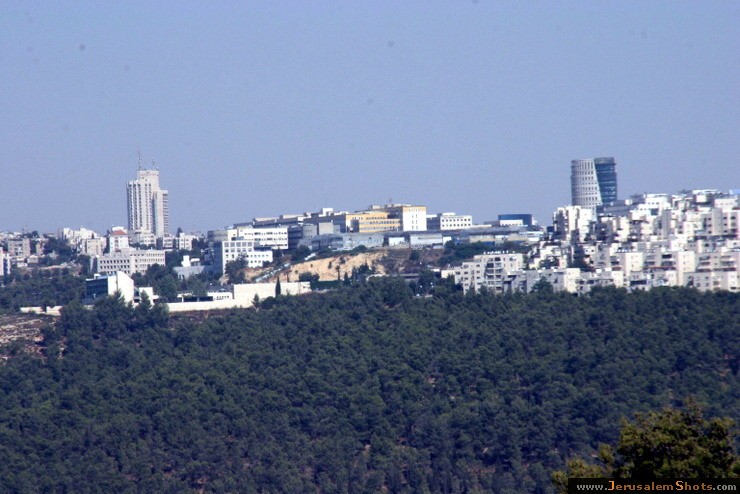
20 July 2009
Mevaseret Yerushalayim (Zion)was established east of Ma'oz Zion in 1956 by Jewish immigrants from North Africa. It was located on a ridge near the armistice line, north of Motza.
Mevaseret Yerushalayim (Zion)was established east of Ma'oz Zion in 1956 by Jewish immigrants from North Africa. It was located on a ridge near the armistice line, north of Motza.
© Valery Dembitsky
\ Views on Jerusalem from Mevaseret Zion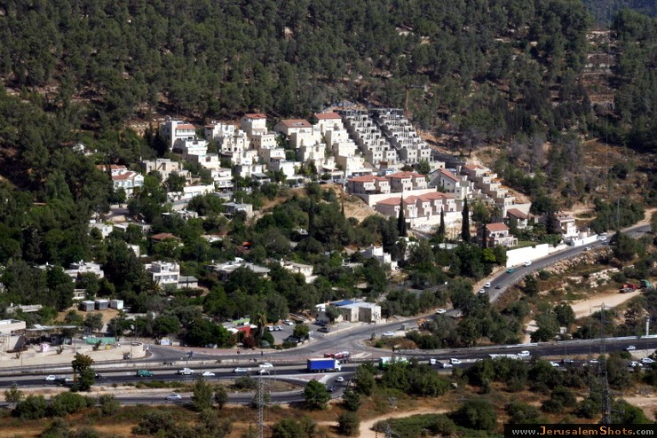
20 July 2009
Mevaseret Yerushalayim (Zion)was established east of Ma'oz Zion in 1956 by Jewish immigrants from North Africa. It was located on a ridge near the armistice line, north of Motza.
Mevaseret Yerushalayim (Zion)was established east of Ma'oz Zion in 1956 by Jewish immigrants from North Africa. It was located on a ridge near the armistice line, north of Motza.
© Valery Dembitsky
\ Synagogue, Mevaseret Zion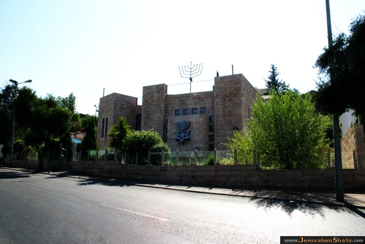
20 July 2009
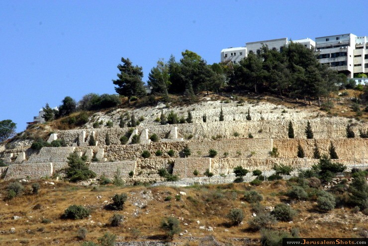
Mevaseret Zion is a suburb of Jerusalem. Today, Mevaseret Zion is composed of two distinct settlements—Maoz Zion and Mevaseret Yerushalayim—under the jurisdiction of one local council. The newer neighborhoods of Mevaseret Zion were not part of either settlement. Mevaseret Zion is located on a mountain ridge 750 meters above sea level, on the outskirts of Jerusalem.
Mevaseret Zion is a suburb of Jerusalem. Today, Mevaseret Zion is composed of two distinct settlements—Maoz Zion and Mevaseret Yerushalayim—under the jurisdiction of one local council. The newer neighborhoods of Mevaseret Zion were not part of either settlement. Mevaseret Zion is located on a mountain ridge 750 meters above sea level, on the outskirts of Jerusalem.
 © Valery Dembitsky
\ Views on Jerusalem from Mevaseret Zion
© Valery Dembitsky
\ Views on Jerusalem from Mevaseret Zion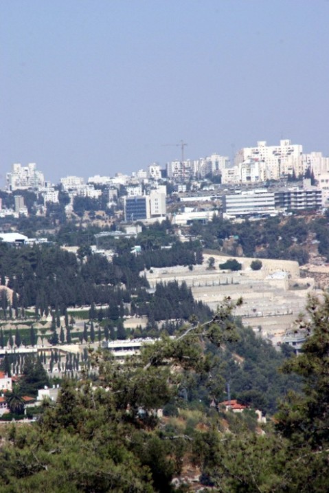
20 July 2009
Mevaseret Yerushalayim (Zion)was established east of Ma'oz Zion in 1956 by Jewish immigrants from North Africa. It was located on a ridge near the armistice line, north of Motza.
Mevaseret Yerushalayim (Zion)was established east of Ma'oz Zion in 1956 by Jewish immigrants from North Africa. It was located on a ridge near the armistice line, north of Motza.